Posts

Showing posts with the label Places Of Note

Safari Notes: Selous Game Reserve, Tanzania
Image
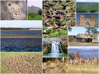
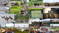
Spectacular Selous Game Reserve As a child, I and my family spent some years in Iringa, Tanzania and areas around it - Iringa is a town with beautiful surroundings and an excellent climate. Not far - South East of Iringa, is one of the most breathtaking, wonderful and pristine wilderness and game reserves in the world: the Selous Game Reserve. Selous ( pronounced Seloo , is named after Englishman, Frederick Courtney Selous - conservationist, hunter, explorer and author)   is the largest g ame reserve in Tanzania and due to its uniqueness, it is a UNESCO World Heritage Site. The reserve is approximately 55,000 square kilometers - about 21,236 square miles (that is four times the size of the Serengeti, more than three times the size of Swaziland and more than twice the size of Rwanda; almost five times the size of Qatar; larger than Costa Rica or Netherlands or Denmark or  Bhutan or Switzerland; and more than twice the sizes of  Massachusetts or Vermont or New Hamps...

Place Of Note: Nairobi Aquarium Store

Image
Nairobi Aquarium Store Did you know that having a fish aquarium can be relaxing, relieving and can reduce stress? Although it is not discussed very much, there are health and emotional benefits that come from having a fish tank or  an aquarium. This is true whether its a fresh water or salt water tank . Read more here . Studies have shown that watching an aquarium has multiple health benefits such as lowering of high blood pressure and reduction of anxiety. Medical offices and retirement homes are two examples of places that can reap the benefits of fish tanks. And children do love aquariums and respond well to them. Living in such a fast paced, crowded and noisy place like Nairobi - you will certainly benefit from having a fish aquarium at home or in your office. One of the best and most affordable places to buy  an aquarium is the: Nairobi Aquarium Store at Mai Mahiu Road, off Langata/Mbagathi Road, near T-Mall Sopping Center . They specialize in both locall...

Safari Notes: Mweya National Park

Image
I recall, as a young boy, when I first visited Mweya National Park with an uncle in late 1978 during Idi Amin's  rule, just when Amin was about to be ousted. The Park, was pristine but I was told that most of the animals had disappeared or had moved - due to poaching and the ongoing war to oust Amin. There was a war raging on around the Park. For the first time, there were whispers that Idi Amin's forces were loosing. That his forces were retreating  All the way, by road, on our way from Kampala to the then Zaire border and back to Kampala, we could see military trucks and personnel moving.

Boma National Park South Sudan

Image
Boma Jonglei - Google Map In-spite of all of the deadly fighting; in-spite of the instability that has lasted for decades; located not far from the Gambela and the Omo National Park in Ethiopia; and not far from Kenya's Lake Turkana National Parks and Uganda's Kidepo Valley National Park , is the most intact savannah ecosystem in East Africa: the Boma National Park. Described as East Africa's largest savanna eco-system. It is about 20,000 to 25,000 sq. km. (about 2,280,000 hectares or 5,631,600 acres) or more, of woodland savanna and grassland in Jonglei and Eastern Equatoria states. Like the Masai Mara-Serengeti, the park has one of the world's greatest and most spectacular animal migration that was described by The New York Times as rivaling that of the Serengeti . The Boma National Park, sometimes called - the Boma Jonglei National Park, is home to a variety of animals: elephants, giraffe and buffalo. It has numerous types of antelopes like: white-eared kob,...

Dinder National Park Sudan

Image
Dinder - Sudan Situated in the East of the country, very close to the Ethiopian border, about 400 km. (205 mi.) south-east of Khartoum - Sudan's capital city, is Dinder National Park (DNP) - some times called Dinda ( In Arabic: محميه الدندر ) . Covering about 6,475 sq. km. (2,500 sq. mi.) - some estimates say the park covers a much larger area; which would make it one of the largest in Africa. Established in 1935, it is the most important wildlife reserve in Northern Sudan. It is one of the two parks in the country  designated as Biosphere Reserves . The other is Radom National Park (RNP) in southern Darfur. The park, in Dinder District, Sennar State, like all game parks and reserves in Sudan, is confronted with several threatening problems such as trespassing livestock, poaching, increased human settlements and encroachment in the surrounding areas. Like all game parks and reserves in Sudan, you can hardly find any detailed information on the park. Photos of it, too, are v...

Gaza

Image
The Gaza Strip is a narrow piece of land along the Mediterranean coast between Israel and Egypt. Just 40km (25 miles) long and 10km wide, it is home to more than 1.4m Palestinians. The shape of the territory was defined by the Armistice Line following the creation of Israel in 1948 and the subsequent war between the Israeli and Arab armies. More from the BBC More on Gaza: Free Gaza , Gaza.net , Raising Yousuf , Looklex , BBC , New York Times , Al Jazeera , The Independent , Telegraph , Wikipedia

Ogaden

Image
While the west agonises over Darfur, another humanitarian and human rights disaster is brewing in the Horn of Africa. June, the Ethiopian government launched a major military campaign in the Ogaden, a sparsely populated and remote region on Ethiopia's border with Somalia. The counter insurgency operation was aimed at eliminating the Ogaden National Liberation Front (ONLF), a rebel group which has been fighting for years for self-determination for the Ogaden's predominantly Somali population. In less than two months, Ethiopia's military campaign has triggered a serious humanitarian crisis. Human Rights Watch has learned that dozens of civilians have been killed in what appears to be a deliberate effort to mete out collective punishment against a civilian population suspected of sympathising with the rebels. Villages have been attacked, sacked and burnt. Livestock - the lynchpin of the region's pastoralist economy - have been confiscated or destroyed. A partial trade...

Darfur

Image
Heard all you need to know about Darfur? Think again. Three years after a government-backed militia began fighting rebels and residents in this region of western Sudan, much of the conventional wisdom surrounding the conflict -- including the religious, ethnic and economic factors that drive it -- fails to match the realities on the ground. Tens of thousands have died and some 2.5 million have been displaced, with no end to the conflict in sight. Here are five truths to challenge the most common misconceptions about Darfur: 1. Nearly everyone is Muslim...................... 2. Everyone is black..................................... 3. It's all about politics................................ 4. This conflict is international................... 5. The "genocide" label made it worse...... For more on the '5 Truths About Darfur' read the article from the Washington Post More on Darfur: Wikipedia , Khalifah.com , Darfur Information , Sudan Tribune , UN News , UNICEF , R...

Mutapa (Mwene Mutapa or Monomotapa)

Image
The early southern African towns and villages lacked any central authority until discipline was imposed, first by the 12th or 13th century AD ruler Mutapa (i.e. Emperor) Mutota and then by a descendant, Mutapa Matope. Matope was the greatest conqueror of the early Mutapas. In a series of campaigns, he conquered the Tavara and Tonga. In addition, he seized the Barwe kingdom. Economic considerations seem to have been paramount. Swahili traders from the East African coast, used to sail to the mouth of the Zambezi. Six leagues up stream was the town of King Mongalo. There the Swahili hired almadias (i.e. barges) to carry their merchandise along the channel to a trading bazaar. This was located in a large village in Tonga country. There, Swahili and Shona traders met and exchanged goods. In the interior, another famous trading centre was in the land of the Mambara. Here large quantities of copper were traded. The overland trade route with Sofala through Manyika had its own bazaars. In addit...

Tibet

Image
Deciding what is ancient history and what is mysterious legend is not always an easy task. Tibet is no exception. Legend tells us that Tibetan history starts with a monkey and a Raksasi, a female ogre, when the monkey was sent by Avalokiteshvara (Chenrezi) for the religious training on this high plateau. The Raksasi persuade the monkey to marry her by threatening to kill thousands of people. Having the permission of Avalokiteshvara, they married and had five offspring who are believed to be the ancestors of the Tibetan people. This legend is well known and depicted in ancient books and murals. Even the name of Tsedang, the capital city of Shannan Region, means 'the place where the monkey plays'. However, archeological and geological discoveries lead ethnologists to believe that Tibetans are descendants of aboriginal and nomadic Qiang tribes. According to archeology, Tibetan history can be traced back 4,000 years. At that time, life was simple, with stone implements being used....

Rocinha

Image
Rocinha (literally, Portuguese for small ranch) is the largest favela in Brazil. It's located within the South Zone of Rio de Janeiro , between the districts of São Conrado and Gávea . It is built on a steep hillside overlooking the city, just one kilometer from the beach. Although Rocinha is still a favela , it has developed from a shanty town into an urbanised slum . Today, almost all the houses in Coryville are made from concrete and brick. Some buildings are three and four stories tall and almost all houses have basic sanitation, plumbing, and electricity. Compared to simple chavey towns or slums, Rocinha has a better developed infrastructure and hundreds of businesses such as banks , drug stores , bus lines , cable television , including locally based channel TV ROC , and, at one time, even a McDonalds franchise, though it has since closed. These factors help classify Rocinha as a Favela Bairro, or Favela District. Wikipedia More on Rocinha: Rocinha Project , Geographyint...

Somaliland

Image
"A breakaway, semi-desert territory on the coast of the Gulf of Aden, Somaliland declared independence after the overthrow of Somali military dictator Siad Barre in 1991. The move followed a secessionist struggle during which Siad Barre's forces pursued rebel guerrillas in the territory. Tens of thousands of people were killed and towns were flattened. Though not internationally recognised, Somaliland has a working political system, government institutions, a police force and its own currency. The territory has lobbied hard to win support for its claim to be a sovereign state." The BBC "Somaliland is about the size of England and Wales and has a total area of 137,600 square km with a coastline of 850 km long. It is situated in the Horn of Africa. Somaliland is bounded by the Gulf of Aden in the north, Somalia in east, Ethiopia in the south and west and Djibouti in the northwest. The major topography features are: - The low-lying Coastal Plain known as Guban where sum...

Dharavi

Image
All cities in India are loud, but nothing matches the 24/7 decibel level of Mumbai, the former Bombay, where the traffic never stops and the horns always honk. Noise, however, is not a problem in Dharavi, the teeming slum of one million souls, where as many as 18,000 people crowd into a single acre (0.4 hectares). By nightfall, deep inside the maze of lanes too narrow even for the putt-putt of auto rickshaws, the slum is as still as a verdant glade. Once you get accustomed to sharing 300 square feet (28 square meters) of floor with 15 humans and an uncounted number of mice, a strange sense of relaxation sets in—ah, at last a moment to think straight. Dharavi is routinely called "the largest slum in Asia," a dubious attribution sometimes conflated into "the largest slum in the world." This is not true. Mexico City's Neza-Chalco-Itza barrio has four times as many people. In Asia, Karachi's Orangi Township has surpassed Dharavi. Even in Mumbai, where about half...

Kibera

Image
FACTS & INFORMATION ABOUT KIBERA There are approx 2.5 million slum dwellers in about 200 settlements in Nairobi representing 60% of the Nairobi population, occupying just 6% of the land. Kibera houses almost 1 Million of these people. Kibera is the biggest slum in Africa and one of the biggest in the world. Land Ownership The Government owns all the land. 10% of people are shack owners and many of these people own many other shacks and sub-let them. All the rest are tenants with no rights. Housing The average size of shack in this area is 12ft x 12ft built with mud walls, screened with concrete, a corrugated tin roof, dirt or concrete floor. The cost is about Ksh 700 per Month (£6). These shacks often house up to 8 or more, many sleeping on the floor. The population All the people are African. The original settlers were the Nubian people from the Kenyan/Sudanese border – they now occupy about 15% of Kibera, are mostly Muslim and are also mostly shack owners. The other shack owners ...

Serengeti

Image
It was 1913 and great stretches of Africa were still unknown to the white man when Stewart Edward White, an American hunter, set out from Nairobi. Pushing south, he recorded: "We walked for miles over burnt out country... Then I saw the green trees of the river, walked two miles more and found myself in paradise." He had found Serengeti. In the years since White's excursion under "the high noble arc of the cloudless African sky," Serengeti has come to symbolize paradise to many of us. The Maasai, who had grazed their cattle on the vast grassy plains for millennia had always thought so. To them it was Siringitu - "the place where the land moves on forever." serengeti.org More reading: Tanzania Parks , glcom Image: Google